
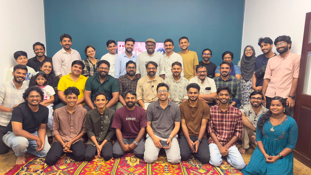
26 June 2026 | Akam The Space, Kallai, Kozhikode
The sun was slowly preparing to disappear into the Arabian Sea, casting a golden glow over the historic banks of the Kallai River. As evening settled in, a small group of around ten people began a walk—not merely through a landscape, but through centuries of history.
Leading the walk was Hamidali Vazhakkad, affectionately known as "Hamidali Mash", an environmentalist, teacher of history, and above all, a passionate storyteller whose words have the remarkable ability to transform ordinary places into living chapters of history.
As the group walked along the riverbank, hundreds of massive timber logs floated silently on the water, just as they have for generations. They were not simply pieces of wood drifting downstream. They were reminders of Kallai's extraordinary past—when this river was one of the world's most significant timber trading centres. Timber harvested from the forests of the Western Ghats travelled through the Chaliyar River before reaching Kallai, from where it embarked on long voyages across the Arabian Sea to distant ports around the world. Every bend of the river carried another story.
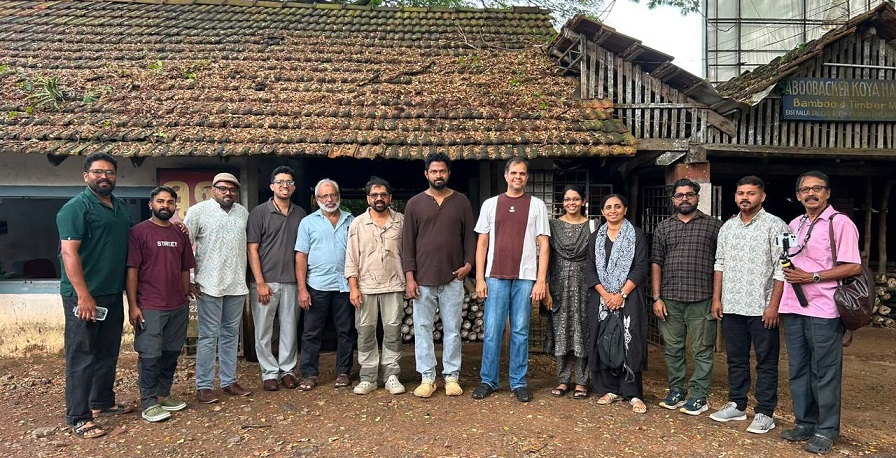
- From the Kallai Storytelling Walk
The storytelling walk concluded at Akam The Space in Thekkeppuram just as the evening sky turned shades of orange and gold. Before the discussion began, participants gathered for a simple yet meaningful traditional Iftar. Sitting together in a circle, they shared dates, fruits, samosas, and the beloved Malabar delicacy Unnakkaya. It was more than a meal; the quiet moments of sharing became a beautiful prelude to an evening dedicated to stories.
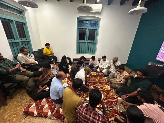
- From Iftar Gathering
The programme, jointly organised by City Heritage Research Guild and Akam The Space, was part of the Human Library initiative, a concept that replaces conventional lectures with conversations, where people become books and stories become a way of learning. Students, teachers, researchers, architects, environmentalists, heritage enthusiasts, and members of the public gathered not for a classroom lesson but to experience history through storytelling.
City Heritage Research Guild continues its mission of studying, documenting, conserving, and celebrating the rich history and heritage of the Malabar region by creating meaningful public engagement with the past. Akam The Space, situated in the historic neighbourhood of Kallai, has emerged as a vibrant cultural hub that encourages dialogue, creativity, learning, and community participation. Together, they created an atmosphere where history became both accessible and deeply engaging.
Drawing primarily from Bhaumachapam: Indian Bhoopada Nirmmanathinte Katha by C. S. Meenakshi, while also referring to India in Triangles: The Incredible Story of How India Was Mapped and the Himalayas Measured by Shruthi Rao and Meera Iyer, Hamidali Vazhakkad unfolded one of the greatest scientific adventures in Indian history—the Great Trigonometrical Survey of India (GTS).
It was not simply the story of measuring land.
It was the story of measuring an entire civilisation.
Beginning on 10 April 1802 at St. Thomas Mount in Madras (present-day Chennai), British surveyor Colonel William Lambton initiated one of the most ambitious scientific enterprises ever undertaken in the subcontinent. At a time when there were no calculators, electricity, railways, radio communication, or satellite technology, surveyors travelled across forests, rivers, deserts, mountains, and coastlines carrying enormous scientific instruments. Guided by the stars and powered by mathematics, determination, craftsmanship, and human endurance, they measured the Indian subcontinent with astonishing precision. What began as an ambitious survey eventually became the foundation of the first scientifically accurate map of India.
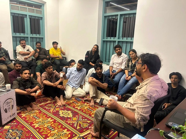
- Hamidali Vazhakkad leading the session on 'Great Indian Survey'
One of the most engaging moments of the evening came when Hamidali challenged a common assumption.
"Everest," he explained, "was not originally the name of a mountain."
It was the surname of George Everest, the British Surveyor General who succeeded William Lambton and significantly advanced the survey. Only later was the world's highest peak named in his honour.
Hamidali Mash then shifted the audience's attention from celebrated names to the thousands of ordinary people who made the survey possible. He recounted an incident in which the survey expedition entered a small village. Seeing hundreds of unfamiliar men accompanied by animals, enormous scientific instruments, carts, and equipment, the frightened villagers initially believed they were facing an invading force. Only later did they realise that these strangers had not come to conquer their land, but to measure it.
The Great Trigonometrical Survey was never a one-man achievement. It was one of the largest scientific expeditions of its time, sustained by an extraordinary network of people working together. Alongside the British officers and Indian mathematicians were engineers, instrument makers, craftsmen, survey assistants, labourers, cooks, tent keepers, porters, guides, elephant and bullock handlers, and countless others whose names have long been forgotten. With caravans of people, animals, tents, and precision instruments, the survey teams travelled across dense forests, scorching deserts, towering mountains, river valleys, and coastlines, overcoming immense physical and logistical challenges.
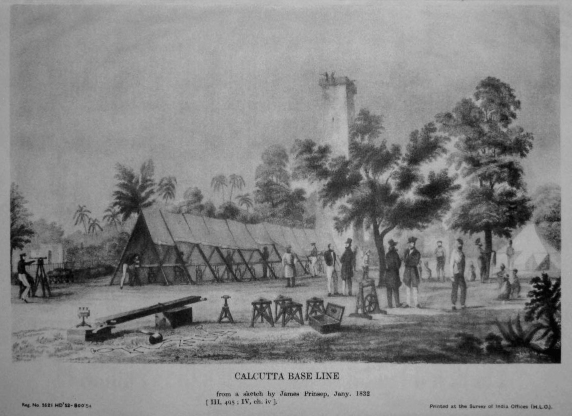
- Measurement of the Calcutta Baseline in 1832, based on a sketch by James Prinsep. This shows surveyors stretching a chain on coffers supported on pickets.
The stories then turned towards the remarkable Indian minds whose contributions have often remained hidden behind history's larger narratives.
Participants discovered the extraordinary story of Radhanath Sikdar, the brilliant Bengali mathematician who became the first person to calculate the height of what was then known as Peak XV. Appointed to the Great Trigonometrical Survey at the age of nineteen as a "computor," Sikdar used advanced mathematical calculations based on observations from multiple survey stations. In 1852, he concluded that Peak XV was higher than Kangchenjunga, which had long been believed to be the tallest mountain in the world. His calculation produced a height of exactly 29,000 feet. To avoid scepticism over such a perfectly rounded number, Surveyor General Andrew Scott Waugh added two feet before officially announcing the height as 29,002 feet in 1856. More than a century later, modern surveys confirmed just how remarkably close Sikdar's calculations had been.
The audience was equally fascinated by the story of Syed Mir Mohsin Husain, an exceptionally skilled jeweller and instrument repairman from the Madras–Arcot region. In 1819, while working in his employer's workshop, British military officers arrived carrying a sophisticated surveying instrument called ‘Theodolite’ that required urgent repair. Although Mohsin had never encountered such a device before, he successfully repaired it through sheer skill and intuition. His remarkable craftsmanship impressed Lieutenant-Colonel Valentine Blacker, who recognised his extraordinary ability. Mohsin subsequently became an indispensable member of the Great Trigonometrical Survey, maintaining the delicate scientific instruments that made accurate measurement possible.
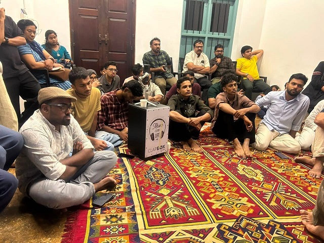
These stories revealed that the Great Trigonometrical Survey was never the achievement of a handful of celebrated individuals. Behind every measurement stood thousands of mathematicians, artisans, craftsmen, labourers, assistants, guides, and surveyors whose dedication made one of history's greatest scientific enterprises possible.
As the stories unfolded, participants realised that a map is much more than lines drawn on paper. Every triangle represented months of travel. Every measurement reflected extraordinary patience and precision. Every coordinate preserved the labour of countless individuals whose names rarely appear in history books. The maps that people now use effortlessly—including those that guide millions through digital platforms such as Google Maps—stand upon centuries of scientific knowledge, craftsmanship, perseverance, and human collaboration.
Story after story, Hamidali Mash painted a vivid picture of the immense human effort behind the making of India's maps, inspiring every participant to see history through a new lens. Around thirty participants attended the session, bringing together students, researchers, history enthusiasts, environmentalists, and members of the wider public. The discussion that followed reflected the curiosity the stories had inspired, with participants sharing questions, observations, and reflections on India's scientific heritage, colonial history, cartography, and the many forgotten individuals whose work continues to shape our understanding of the country today.
As a token of appreciation, City Heritage Research Guild presented Hamidali Vazhakkad with a nutmeg sapling. Danish, Co-founder of Akam The Space, welcomed the gathering, while Muhammed Shihad, Founder of City Heritage Research Guild, delivered the vote of thanks. The programme was coordinated by City Heritage Public Relations Officer Haseebe Ahamed, Administrator Yasin Asharaf, Sahal, and Shamil.
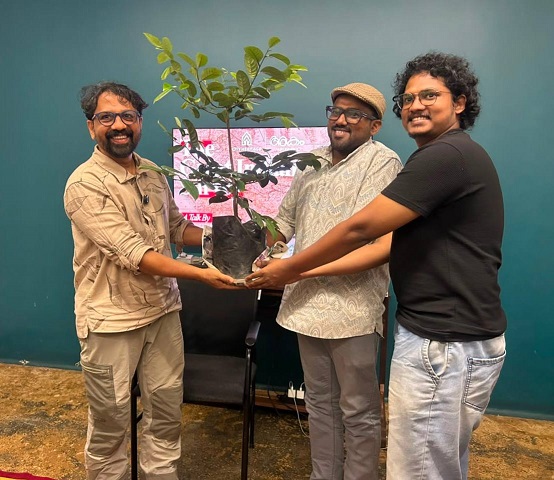
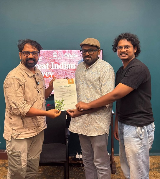
- City Heritage Founder Muhammed Shihad and Akam Co-founder Danish presenting a nutmeg sapling nd a certificate to Hamidali Vazhakkad as a token of appreciation.
The evening beautifully reflected the vision of the Human Library initiative - to create spaces where people gather not merely to listen, but to question, discuss, reflect, and rediscover history through meaningful conversations. As participants left Akam The Space and stepped back into the quiet streets, they carried with them a new understanding that every map tells a story, every place holds a memory, and every chapter of history is ultimately the story of people.




 (1).png)
© Copyright 2026 City Heritage. All rights reserved.
Website designed by TNM Online Solutions.
If you have any enquiry, feel free to ask, and we'll provide you with a prompt and concise response.